Save 15%


Sold out
I order more books. They should be here about 22 March, 2023
The price of the limited edition is currently set at $14 each, while supplies last.
Book size: 6" x 9" x 0.410" with 344 pages, weighing 15 oz. or 525 grams.
Here are just a few features in the guidebook:
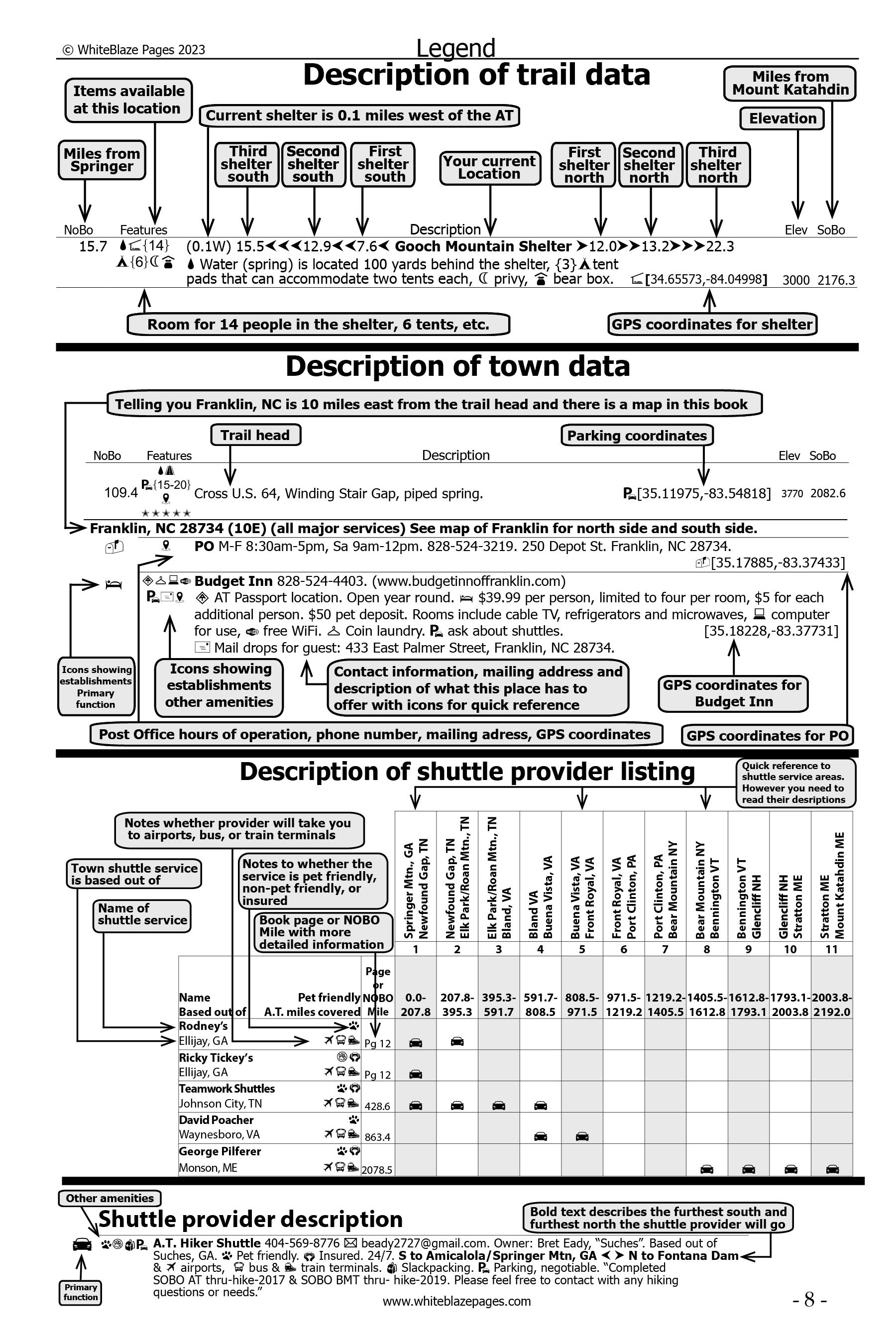
- Mileages for NOBO hikers are on the left outer edge of the pages. For SOBO hikers the mileages are on the right outer edge of pages. This was done so that you could easily thumb through the pages and find the mileage point you’re looking for very quickly for both NOBO and SOBO hikers. No other guidebook does this.
- Easy-to-read descriptions, coordinates, and elevations, listing over 4,946 data entry points of trail-worthy information, (more than any other Appalachian Trail guidebook), allowing for easy use, no matter what direction you are hiking, NOBO, SOBO, or flip-flop, a unique feature of this guidebook.
- Easy-to-turn pages with quick identification tabs in the top, outer corners, to help you rapidly find the needed trail data in the guidebook.
- Over 5,000 GPS coordinates listed in this guidebook locating shelters, trail heads, road crossings, landmarks, establishments, attractions, and also listing Appalachian Trail parking locations, with parking capacities.
- Over 700 listings of possibilities for parking locations.
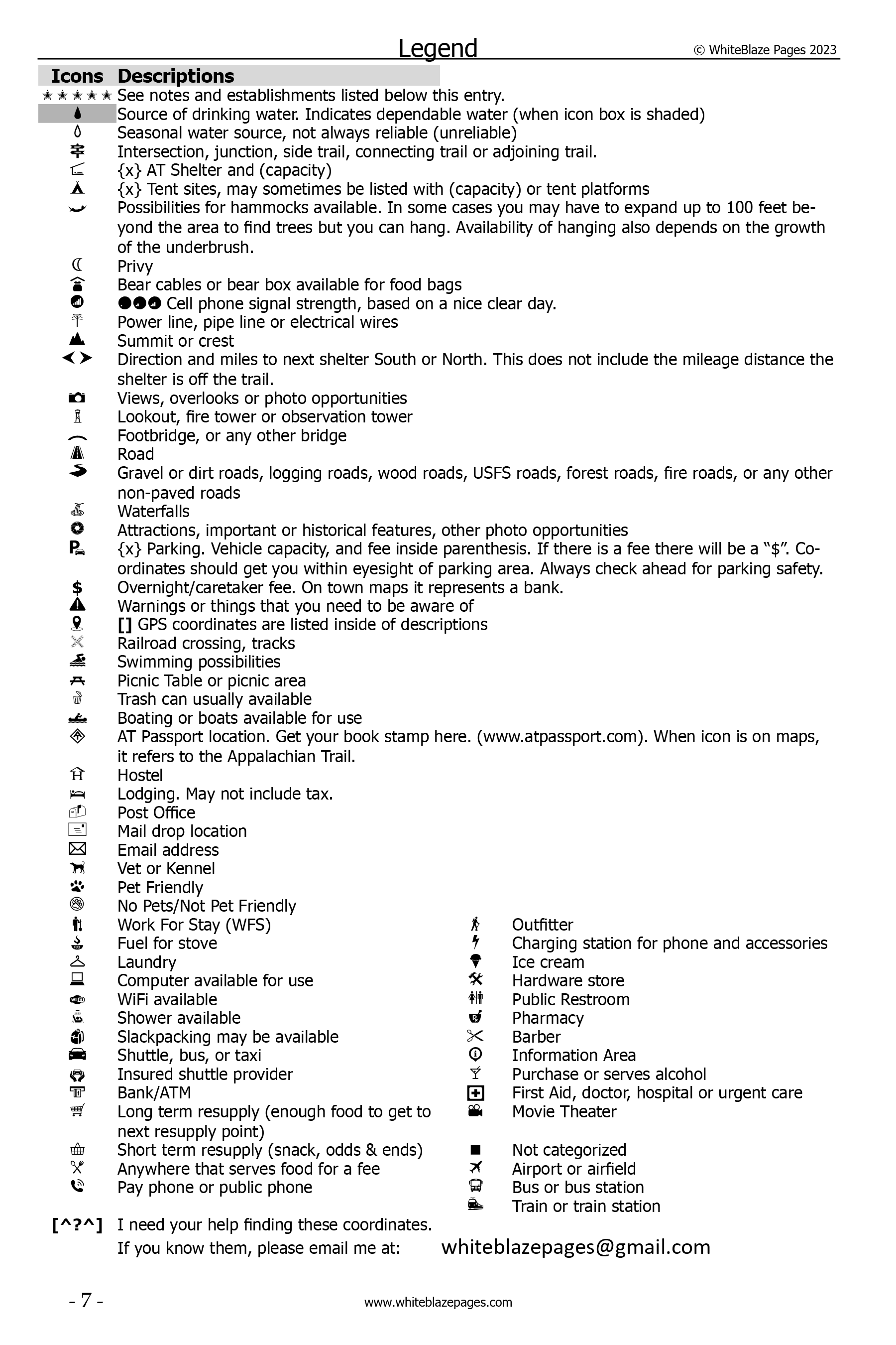
- Quick-reference icons (74) and colors, associated with detailed descriptions that allow you to rapidly determine the availability of needed services, at any particular location.
- 142 maps and road crossings maps are in the guidebook to better assist the hiker.
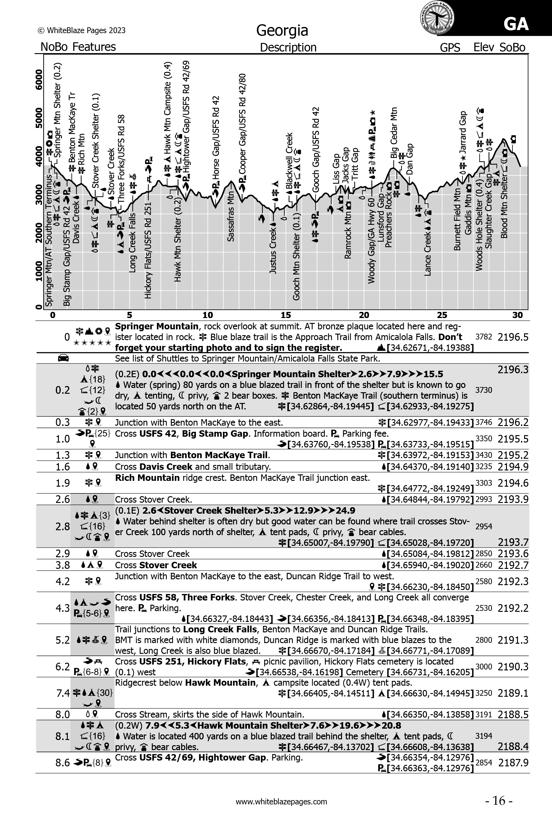
- Up-to-date elevation profile maps, in easy to read 30-mile sections, displaying locations, with quick-reference icons positioned adjacent to the locations, items listed on profiles are in bold type in the accompanying description.
- All items listed on the profiles are bolded on the data pages for quick reference.
- Each shelter location shows the mileage to the next three shelters north, and south, for quick reference.
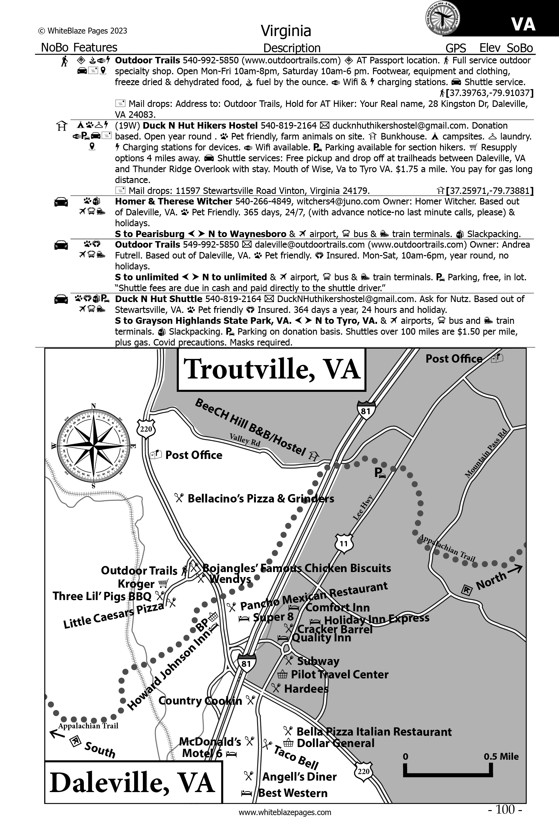
- City and town informational entries, in sequential order, referenced to trail mileage, in detail. No need to flip back-and-forth, 2 or 3 pages through the guidebook to locate needed information, unlike in other guidebooks.
- All maps are printed to scale, north oriented, showing the locations of thousands of establishments providing needed services, unlike other guidebooks that do not have their maps to scale.
- Many trail features: side trails, waterfalls, bridges, scenic views, attractions, road crossings, bridges, power lines, warnings, and much, much more!
- Complete Post Office addresses, phone numbers, and GPS coordinates in the town’s listings.
- Post Offices are also listed in their physical locations where you would use them along the Appalachian Trail.
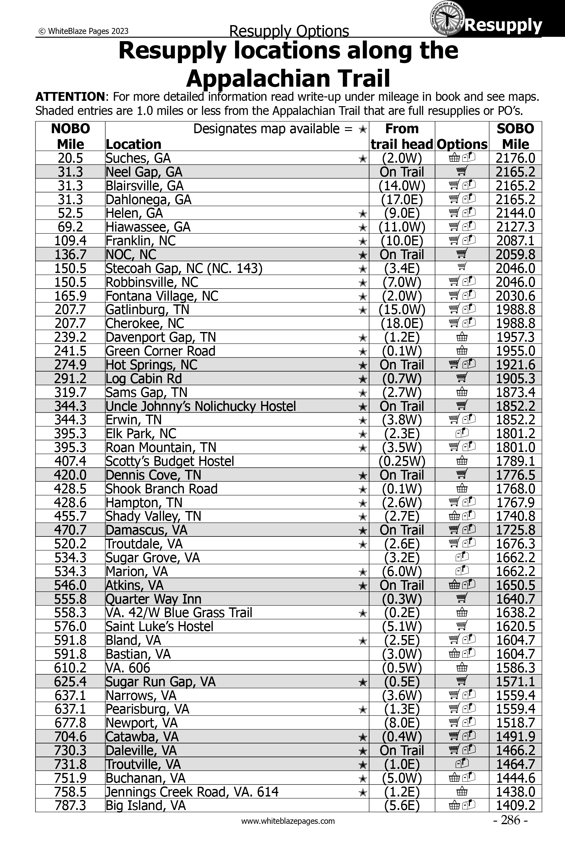
- Listing of Appalachian Trail resupply locations. Good for pre-hike planning.
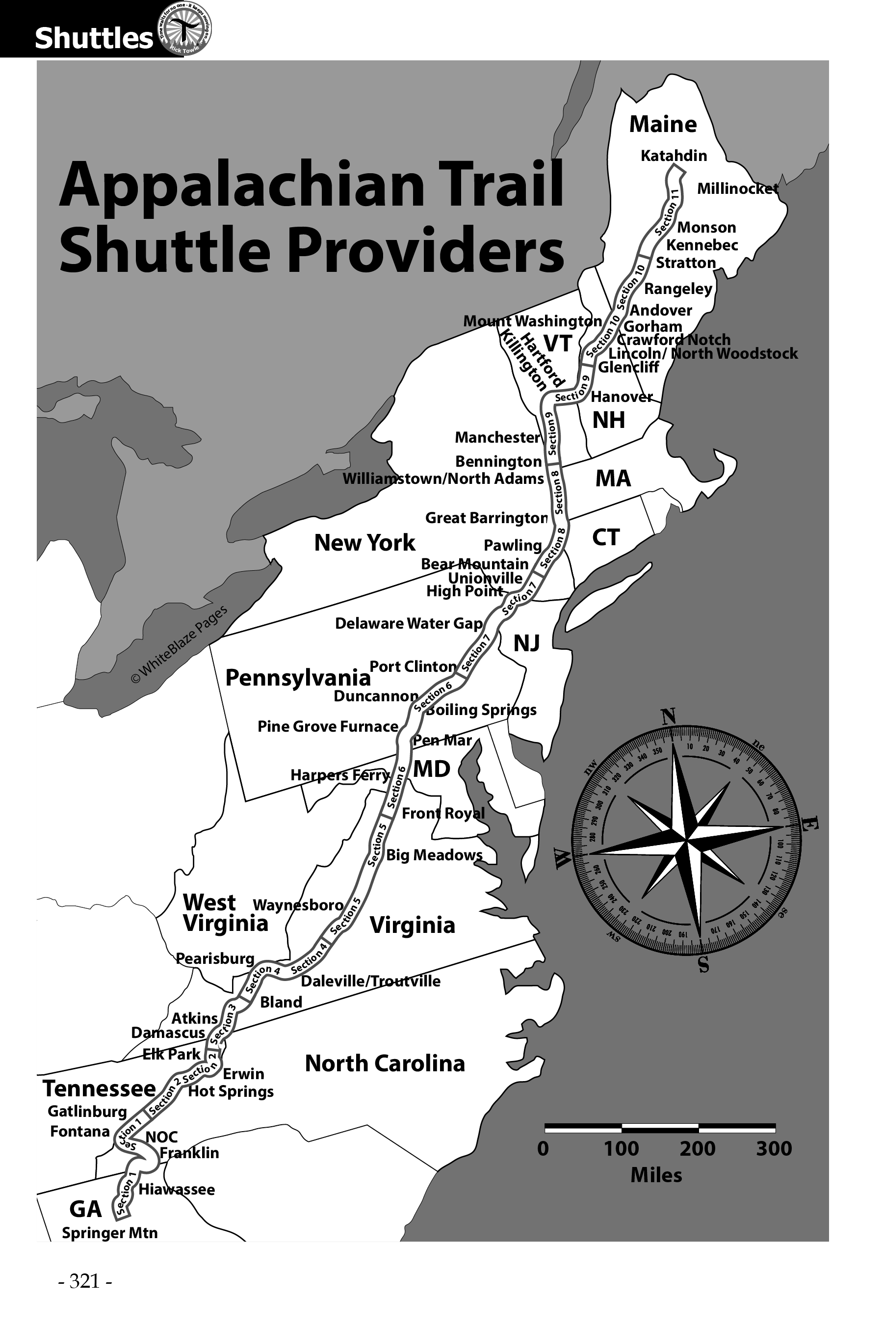
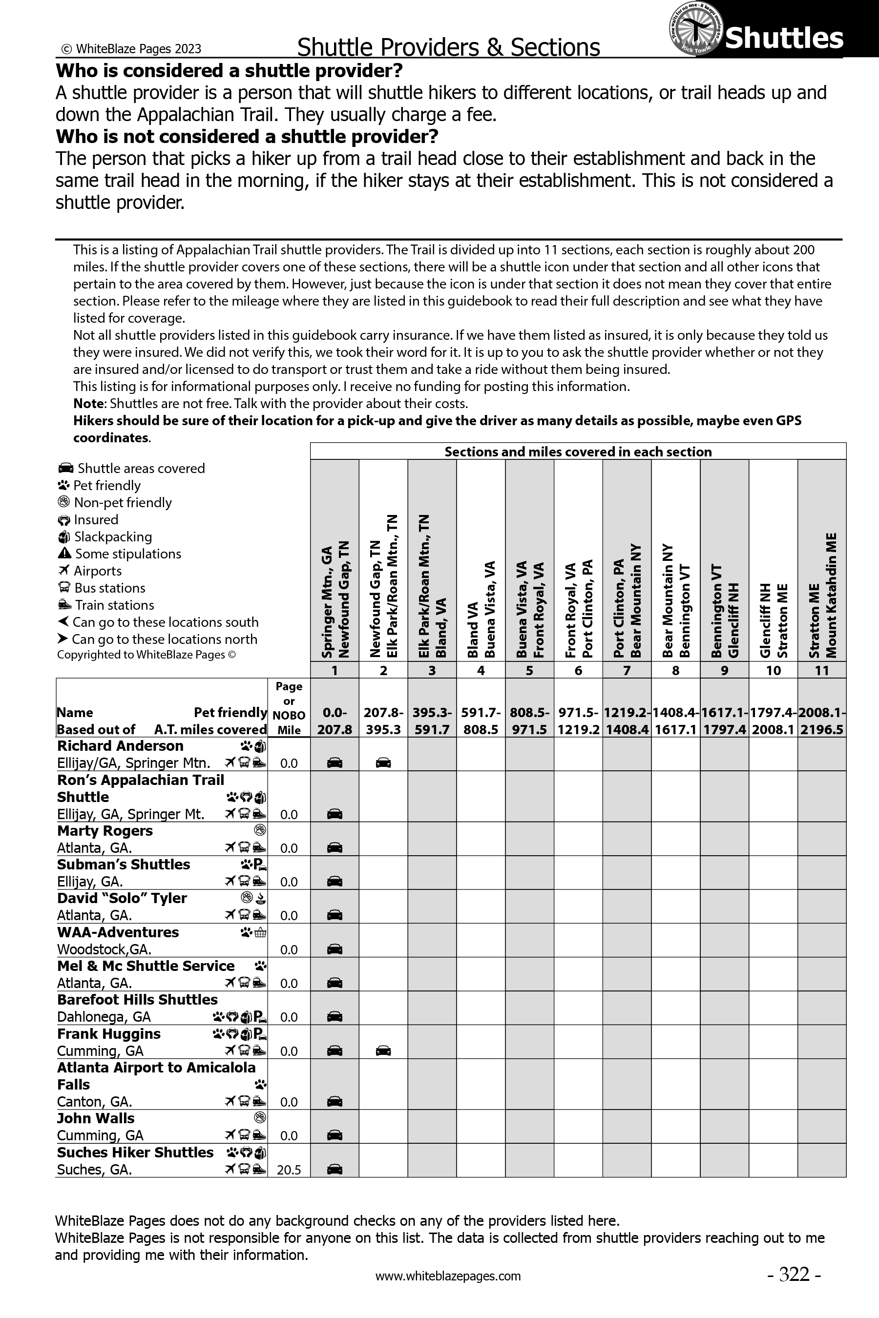
- Includes an extensive listing of all shuttle providers along the entire length of the Appalachian Trail, with descriptions and shuttle service area map. The most up-to-date listing in publication!
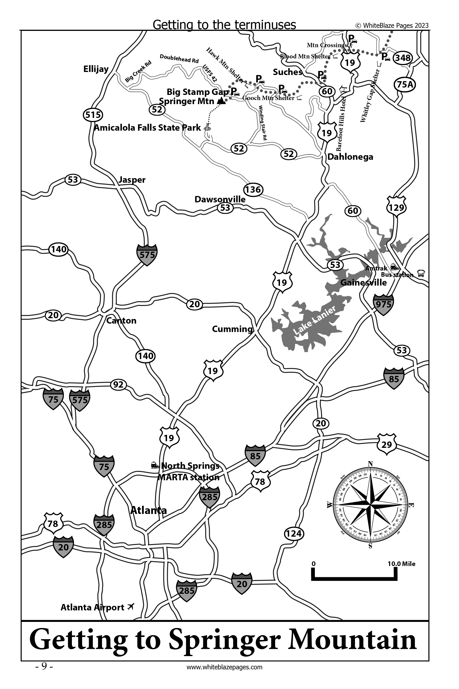
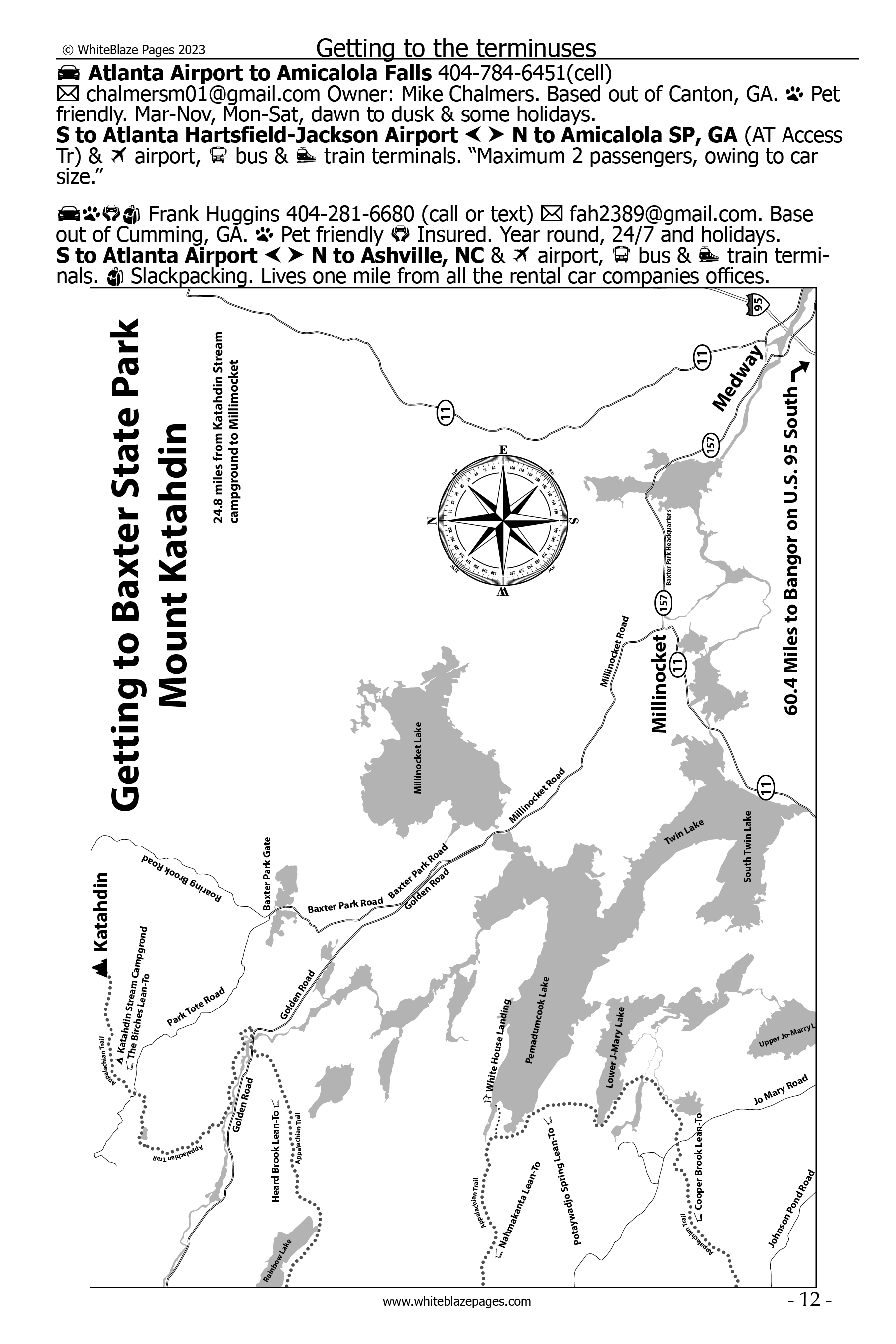
- Approach Trail, including profile, elevations, coordinates, and Amicalola Falls State Park information.
- Contains a separate Hostel listing of all Hostels. Hostels are also listed in their physical locations where you would use them along the Appalachian Trail.
- Includes a table of contents. Index for the book, and index of maps included in the book.
- Appalachian Trail Hostel and campground listing.
- Listing of Appalachian Trail resupply locations. Good for pre-hike planning.
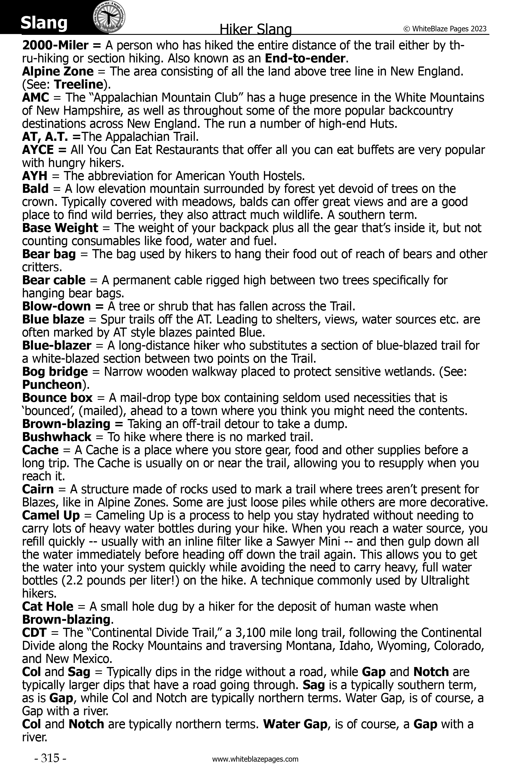
- Hiker Slang, commonly used hiker terms.
- Index in the back of the book listing all AT shelters, trail towns, some hostels, and historic places.
- Index in back of the book listing all town maps in the book.
- Many more features, but unable to list all of them here.

Click image to download sample PDF