


The 2022 Long Trail Pages PDF
This is an interactive PDF file of the 2022 Long Trail Pages Guidebook.
It was designed and created for use with mobile devices
This PDF has all the features of the basic PDF version of the guidebook and more.
The interactive PDF includes phone numbers, email addresses, web site URL’s, and GPS coordinates that are all live active links that will work with your mobile device. When you click on a link, it will open in conjunction with the app on your mobile device.
When you click on the GPS coordinates in the PDF it takes you to the location of the coordinate on the map in the Gaia GPS app or through the browser. You are not required to have the Gaia GPS app to use this PDF. If you choose not to use Gaia GPS app, the GPS coordinates will try to open in your browser.
Gaia GPS: Gaia GPS incorporates all the functions of a GPS. You have the options of logging waypoints, creating tracks, switching between maps, and a few other functions.
The basic app Gaia GPS is free. I have created some shared folders for you for use with Gaia GPS to help assist you in viewing the Appalachian Trail Centerline and locations.
There are additional features you can subscribe to and pay for on Gaia GPS but none of those features are needed to use the Long Trail Pages PDF Guidebook in conjunction with this PDF.
** Be notified of PDF updates and download the newest version for free. **
Directions and the Long Trail Pages PDF Guidebook will be available for download on completion of purchase.


Features:
- Long Trail Pages is designed for easy use by all variety of hikers: day hikers, section hikers, and long-distance thru-hikers, (NOBO, SOBO, and flip-floppers). Its goal is to assist you to quickly determine your location and surrounding terrain features, and to find nearby re-supply options and other needed services.
- Easy-to-turn pages with quick identification tabs in the top, outer corners, to help you rapidly find the needed trail data in the guidebook.
- Easy-to-read descriptions, coordinates, and elevations, with separate North-Bound (NOBO), and South Bound (SOBO), mileage columns, listing 710 data entry points of trail-worthy information, (more than any other Long Trail guidebook), allowing for easy use, no matter what direction you are hiking, NOBO, SOBO, or flip-flop, a unique feature of this guidebook.
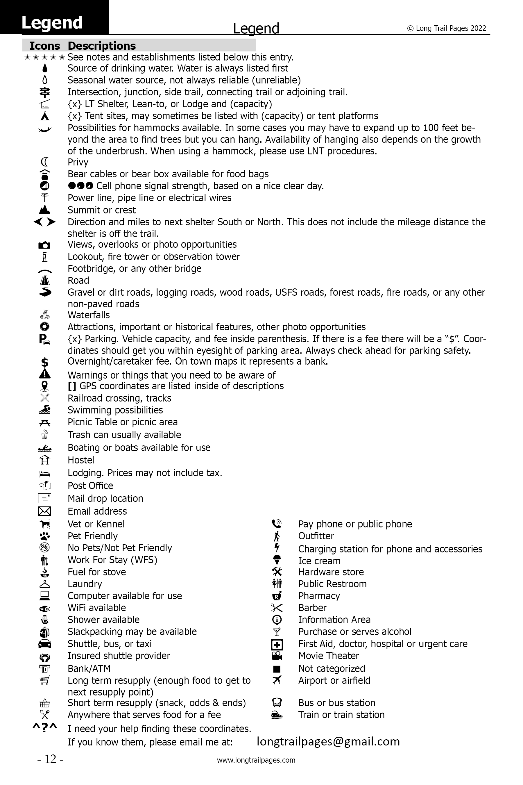
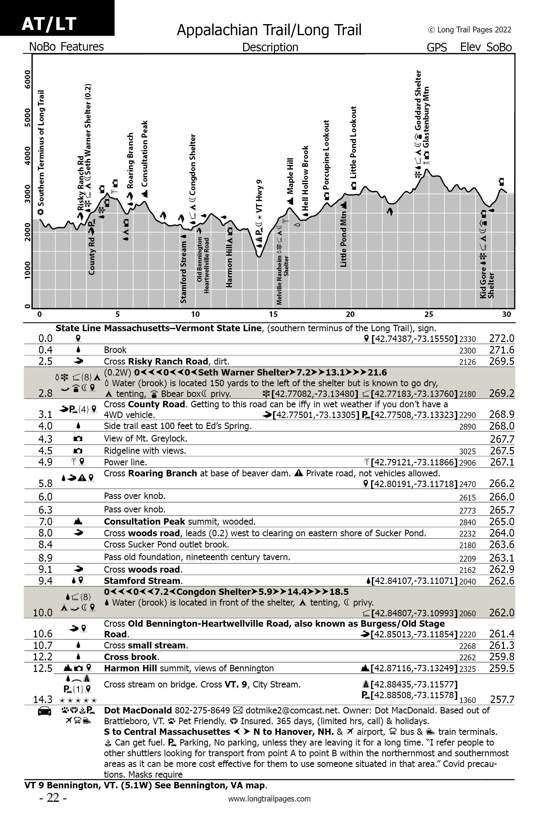
- Quick-reference icons (66), associated with detailed descriptions that allow you to rapidly determine the availability of needed services, at any particular location.
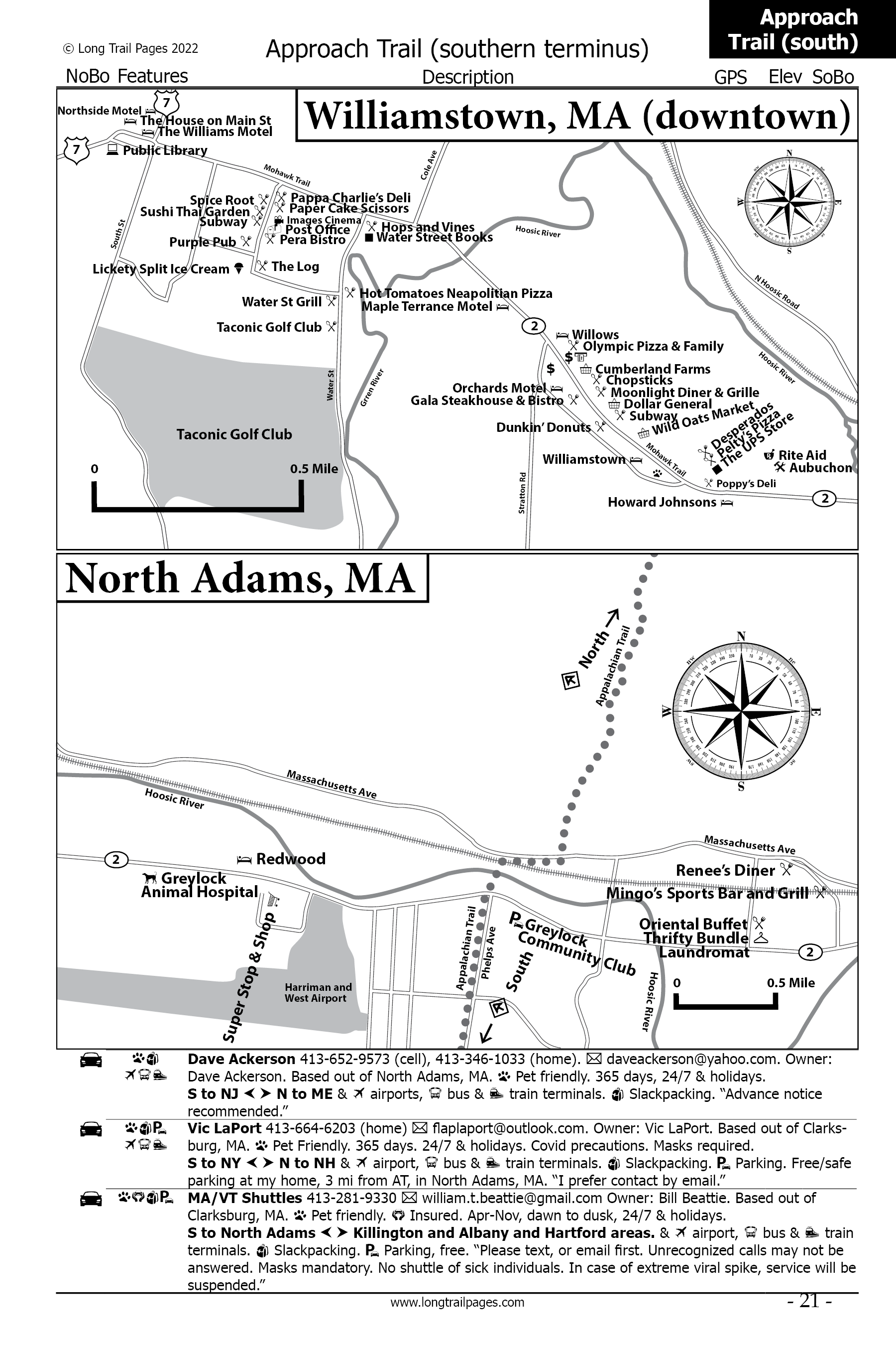
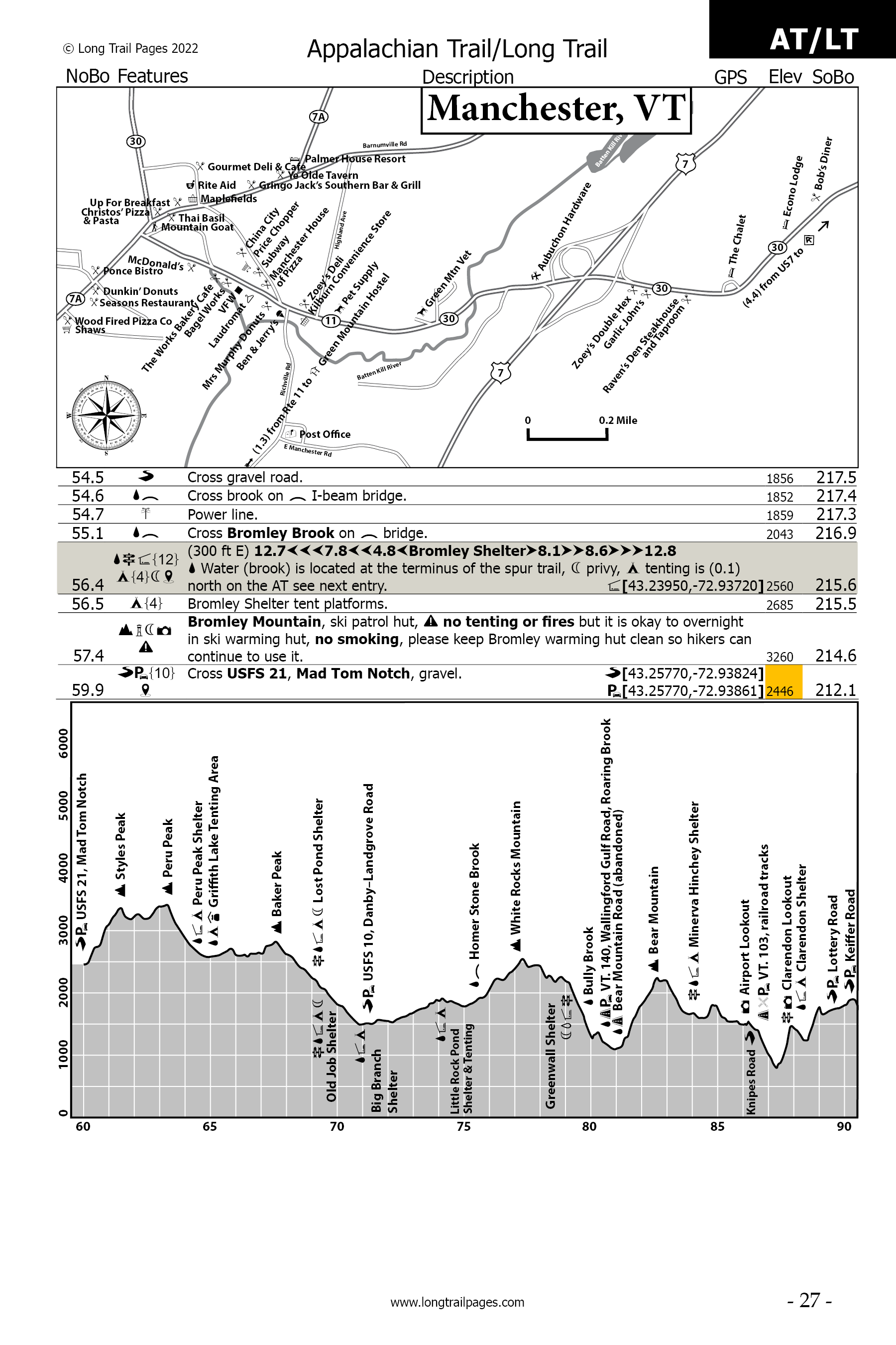
- City, and town, informational entries, in sequential order, referenced to trail mileage, with detailed, all-to-scale, north-oriented maps, showing the locations of thousands of establishments providing needed services. No need to flip back-and-forth, 2 or 3 pages through the guidebook to locate needed information.
- Many more trail features: side trails, waterfalls, bridges, scenic views, attractions, road crossings, bridges, power lines, warnings, and much, much more!
- Over 610 GPS coordinates listed in this guidebook locating shelters, trail heads, road crossings, landmarks, establishments, attractions.
- Complete Post Office addresses, phone numbers, and GPS coordinates in the town’s listings.
- Up-to-date elevation profile maps, in easy to read 30-mile sections, displaying locations, with quick-reference icons.
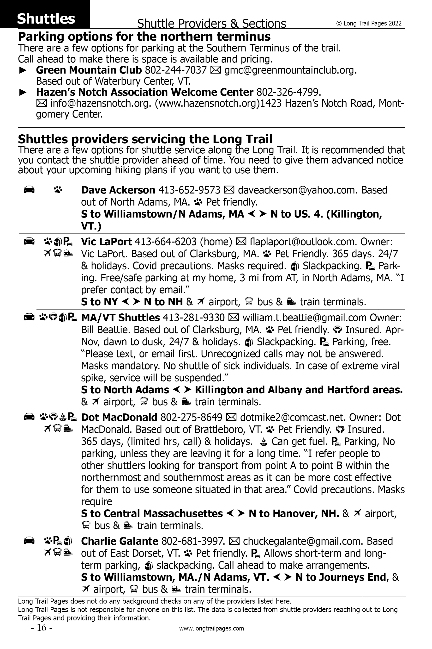
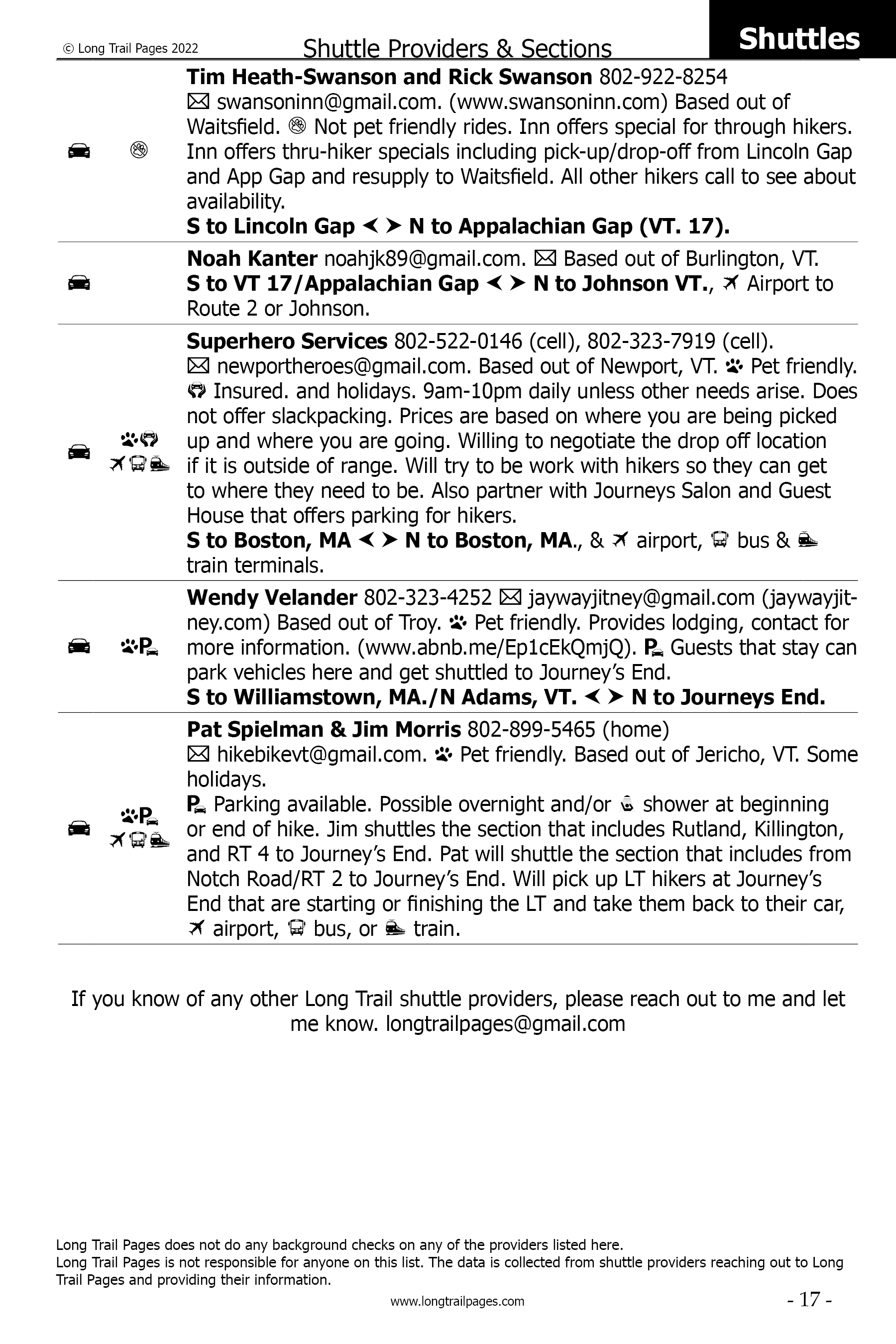
- Includes the shuttle provider listing, of all shuttle providers along the entire length of the Long Trail, with descriptions.
- Compare for yourself with other guidebooks. More data and pages. Lighter, thinner, and easier to read.
- Approach Trails, including profile, elevations, coordinates.
- Over 60 parking coordinates.
- Listing of Long Trail resupply locations. Good for pre-hike planning.
- Hiker Slang, commonly used hiker terms.
- List of Post Offices.
- Index in the back of the book listing all shelters, lodges, campsites, trail towns, some hostels and historic places.
- Index in back of book listing all town maps in the book.
- Larger icon that denotes what each establishment’s primary function is, followed by the other icons that they offer for services.
- Many more features, but unable to list all of them here.

Click image to download sample PDF
This is a sample of the Long Trail Pages PDF.
It does not include the entire PDF, but it gives you enough to see what is included in the book.
I have included the entire both the Pine Cobble and AT Approach Trails and from the southern terminus of the Long Trail to Manchester, VT.
| File name | File size |
|---|---|
| Long Trail Pages 2022 Interactive PDF- V1 Released 01/26/22 | 4,142 Kb |