Save 73%


The 2024 WhiteBlaze Pages PDF
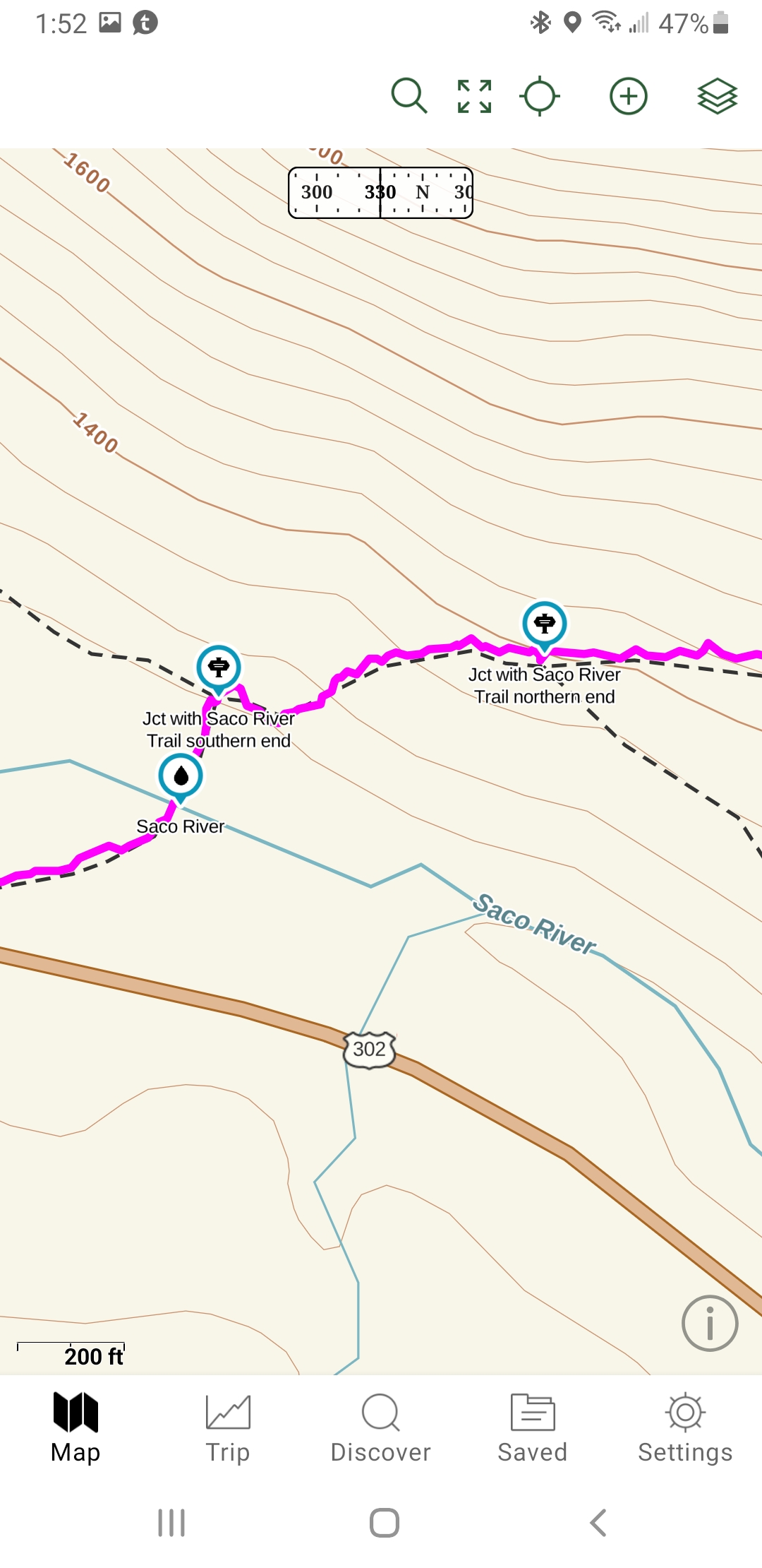
Works in conjunction with Gaia GPS!
This is an interactive PDF file of the 2024 WhiteBlaze Pages Guidebook.
It was designed and created for use with mobile devices. However, it will work on any device.
Why so cheap you're wondering.
It's because I am not doing this to make money or rip off hikers.
I really enjoy helping hikers.
All I want is to make enough to pay for my server costs. If I could do this for free, I would.
The interactive PDF includes phone numbers, email addresses, web site URL’s, and GPS coordinates that are all live active links that will work with your mobile device.
When you click on a link, it will open in conjunction with the app on your mobile device.
When you click on the GPS coordinates in the PDF it takes you to the location of the coordinate on the map in the Gaia GPS app or through the browser. You are not required to have the Gaia GPS app to use this PDF. If you choose not to use Gaia GPS app, the GPS coordinates will try to open in your browser.
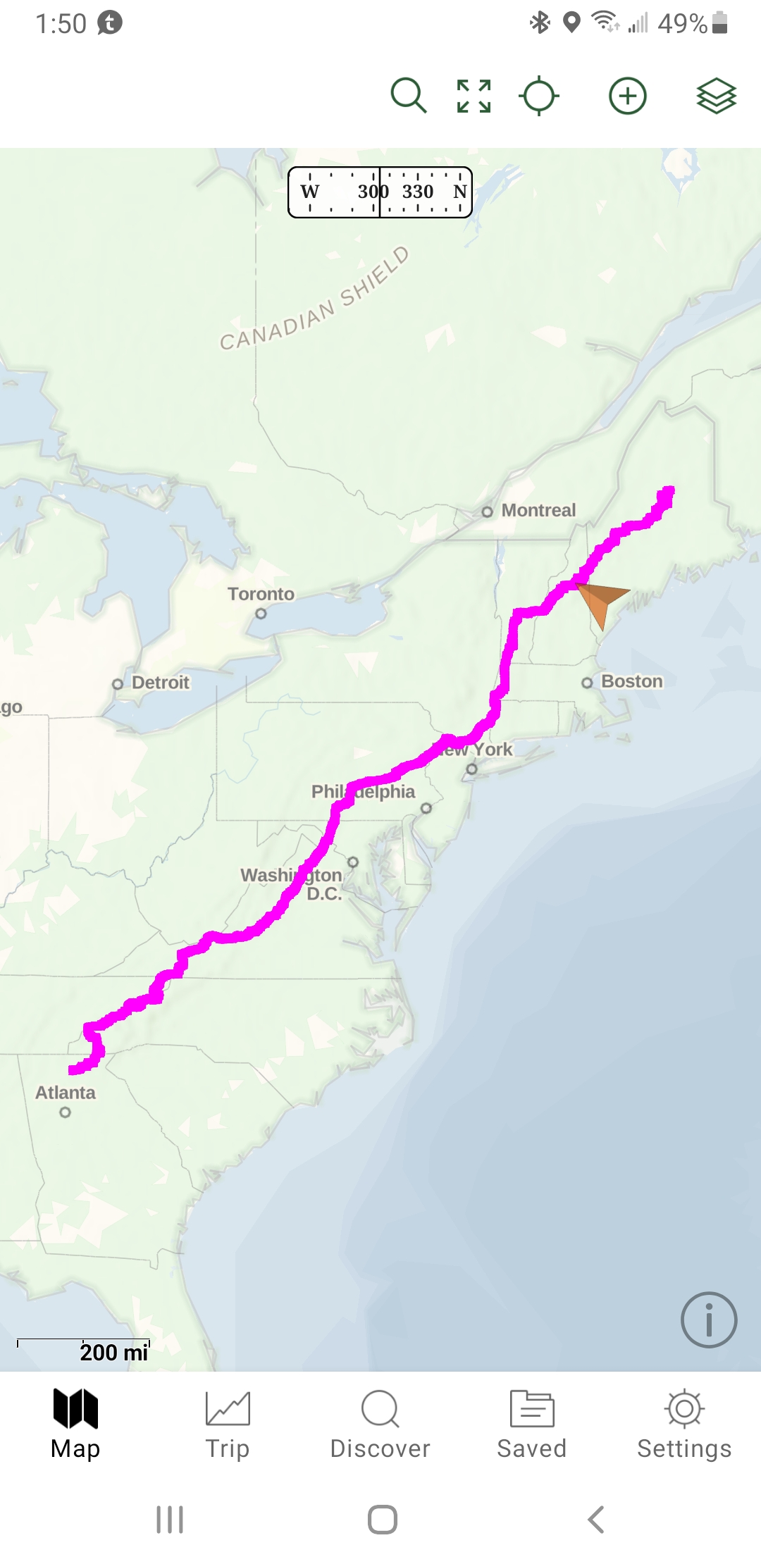
Gaia GPS: Gaia GPS incorporates all the functions of a GPS. You have the options of logging waypoints, creating tracks, switching between maps, and a few other functions.
The basic app Gaia GPS is free. I have created some shared folders for you for use with Gaia GPS to help assist you in viewing the Appalachian Trail Centerline and locations.
There are additional features you can subscribe to and pay for on Gaia GPS but none of those features are needed to use the WhiteBlaze Pages PDF Guidebook in conjunction with this PDF.
** Be notified of PDF updates and download the newest version for free. **
Directions and the WhiteBlaze Pages PDF Guidebook will be available for download on completion of purchase.


Click image to download sample PDF
This is a sample of the 2024 WhiteBlaze Pages PDF.
It does not include the entire PDF, but it gives you enough to see what is included in the book.
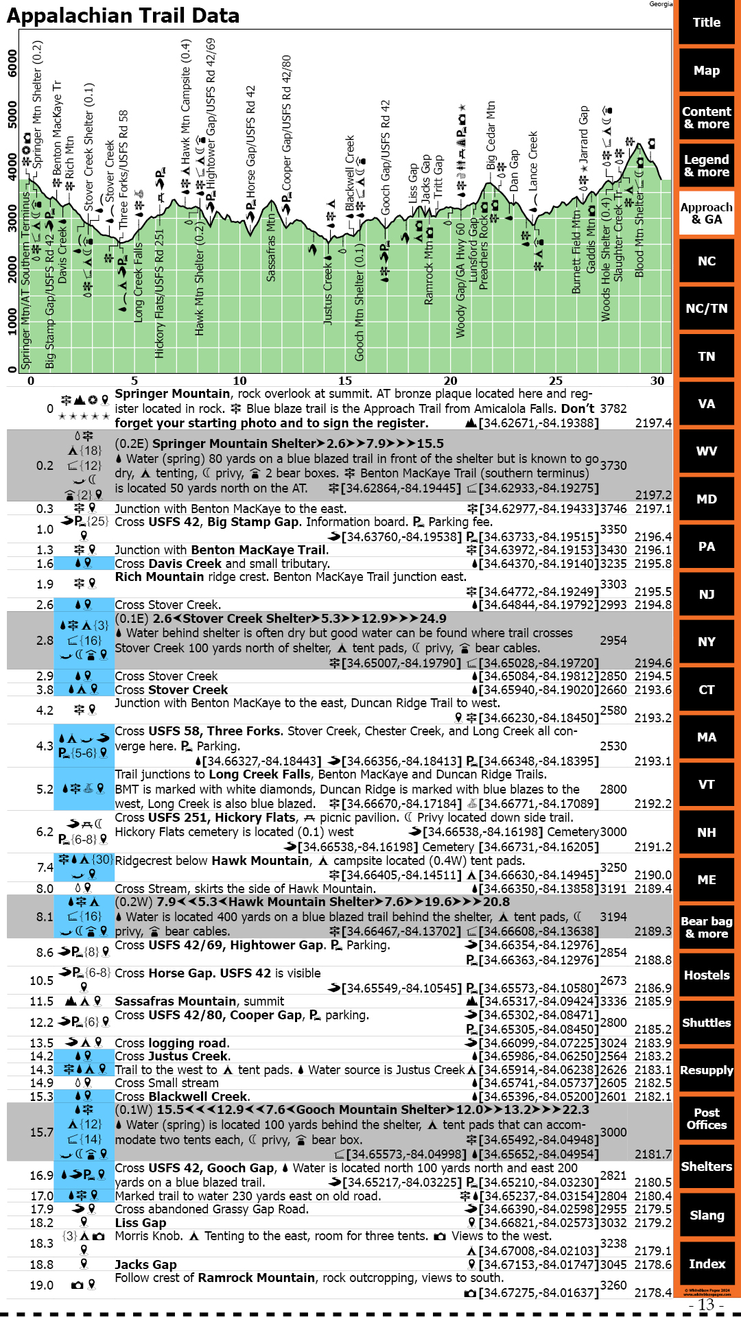
I have included the entire Approach Trail and the Appalachian Trail from Sprinter Mountain to Franklin, NC.
Here are just a few more features included in the PDF
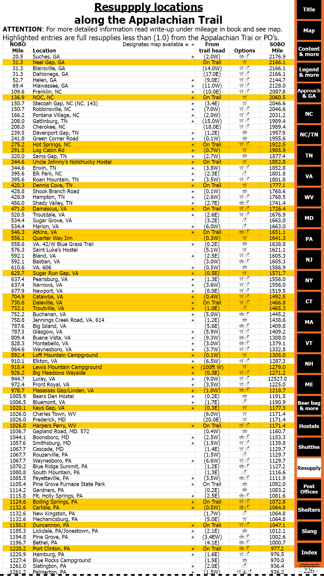
- WhiteBlaze pages is designed for easy use by all variety of hikers: day hikers, section hikers, and long-distance thru-hikers, (NOBO, SOBO, and flip-floppers). Its goal is to assist you to quickly determine your location and surrounding terrain features, and to find nearby re-supply options and other needed services.
- Mileages for NOBO hikers are on the left outer edge of the pages. For SOBO hikers the mileages are on the right outer edge of pages. This was done so that you could easily thumb through the pages and find the mileage point you’re looking for very quickly for both NOBO and SOBO hikers. No other guidebook does this.
- Easy-to-read descriptions, coordinates, and elevations, listing over 4,904 data entry points of trail-worthy information, (more than any other Appalachian Trail guidebook), allowing for easy use, no matter what direction you are hiking, NOBO, SOBO, or flip-flop, a unique feature of this guidebook.
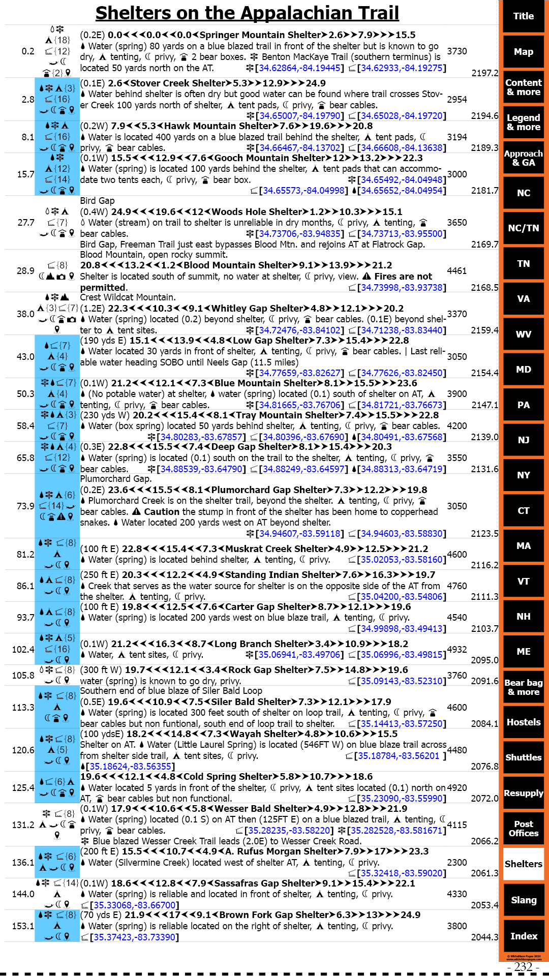
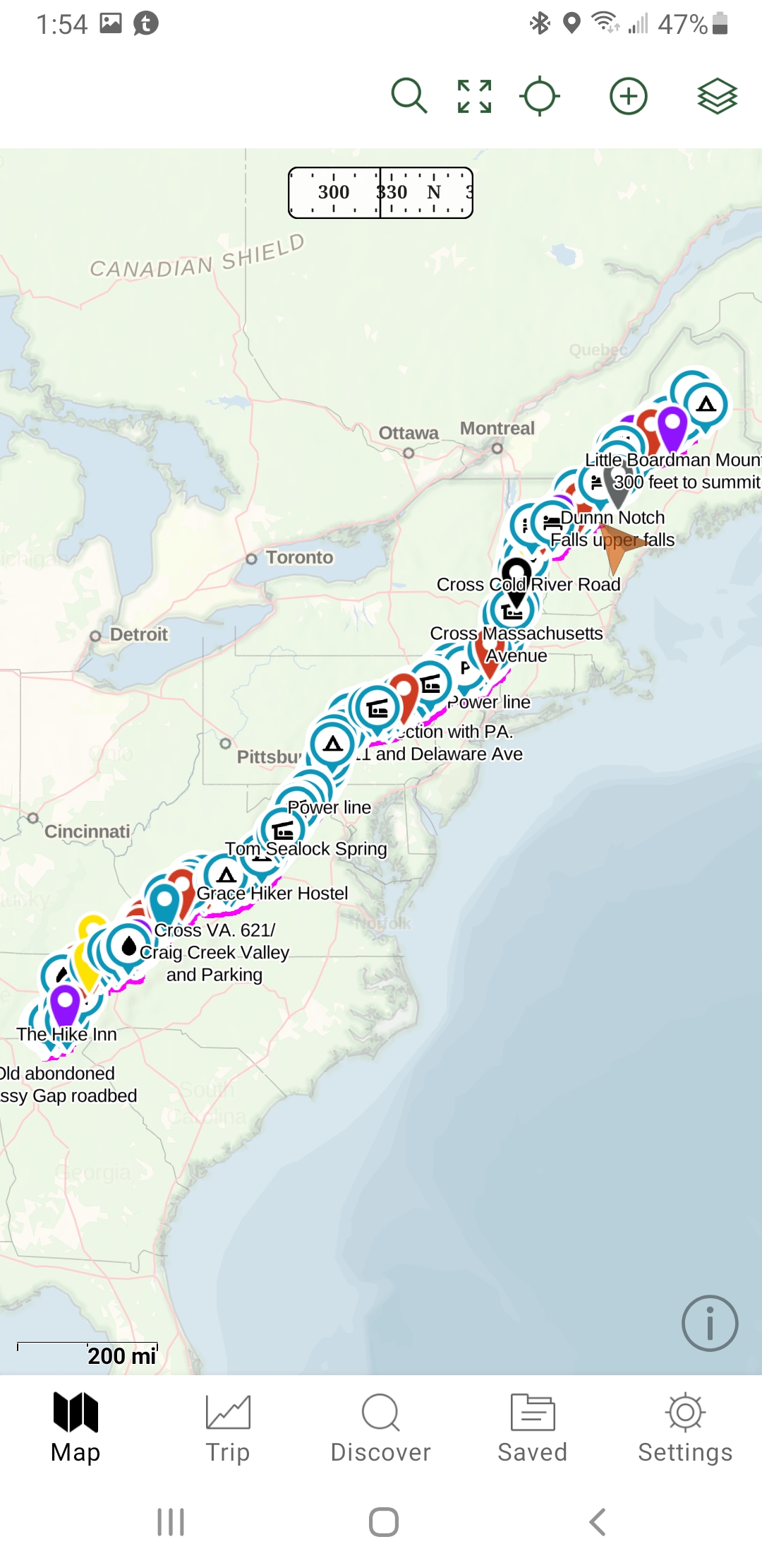
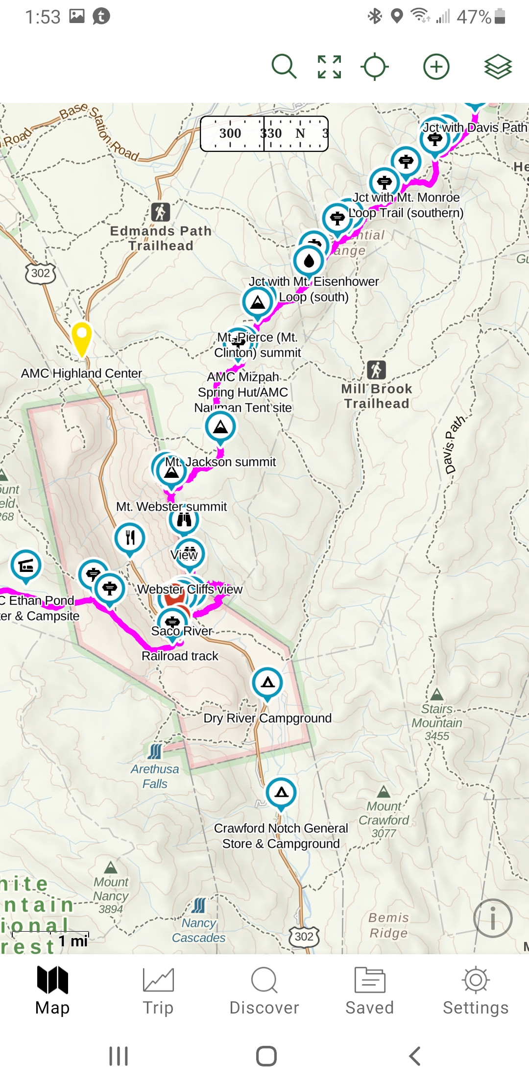
- Over 5,000 GPS coordinates listed in this guidebook locating shelters, trail heads, road crossings, landmarks, establishments, attractions, and also listing Appalachian Trail parking locations, with parking capacities.
- Over 700 listings of possibilities for parking locations.
- Quick-reference icons (74) and colors, associated with detailed descriptions that allow you to rapidly determine the availability of needed services, at any particular location.
- Background colors are highlighted for quick reference to hostels, shuttle providers, shelters, State lines, Post offices, and dependable water sources. Color blind friendly.
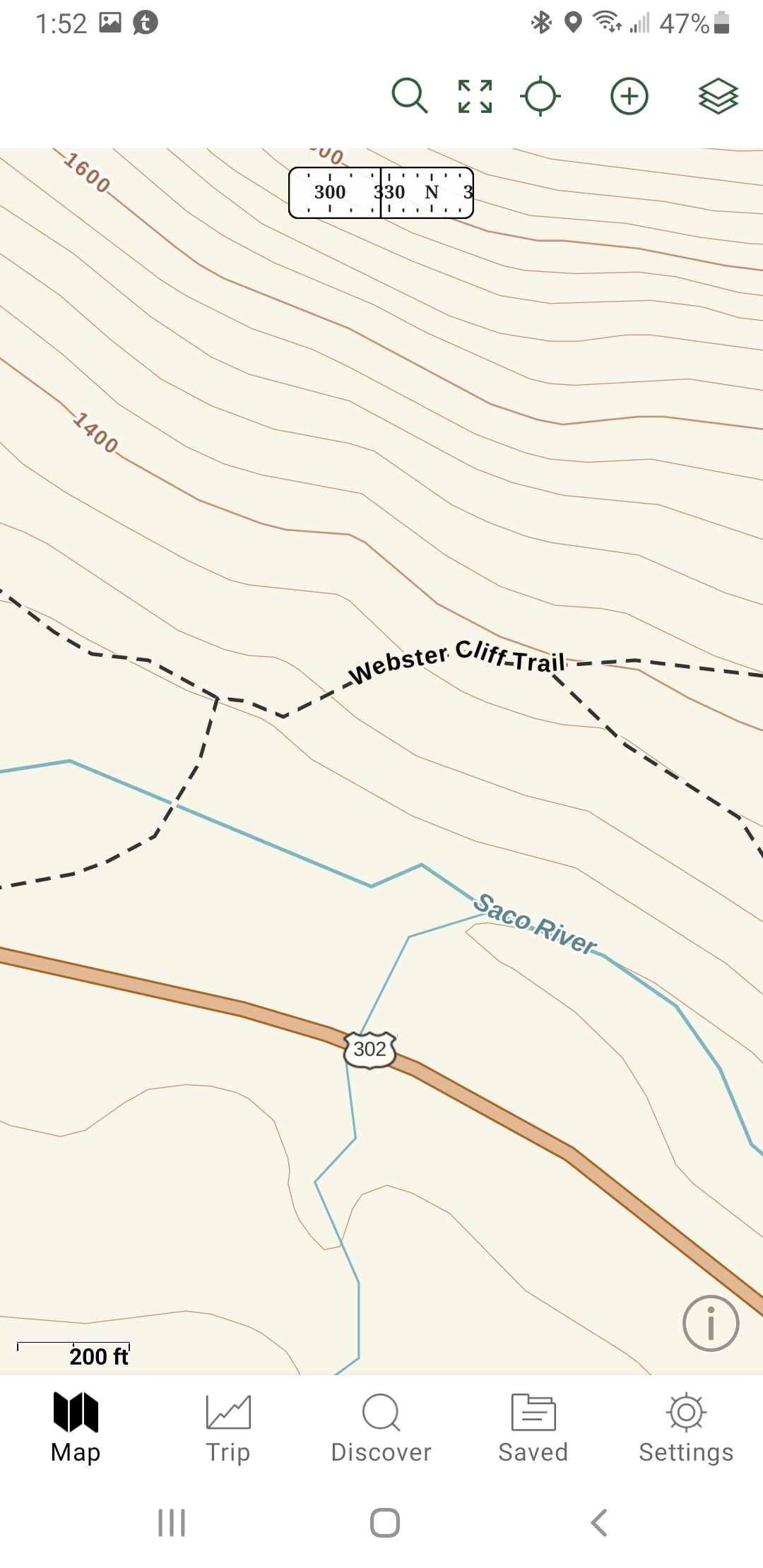
- 142 maps and road crossings maps are in the guidebook to better assist the hiker.
- Up-to-date elevation profile maps, in easy to read 30-mile sections, displaying locations, with quick-reference icons positioned adjacent to the locations, items listed on profiles are in bold type in the accompanying description.
- All items listed on the profiles are bolded on the data pages for quick reference.
- Each shelter location shows the mileage to the next three shelters north, and south, for quick reference.
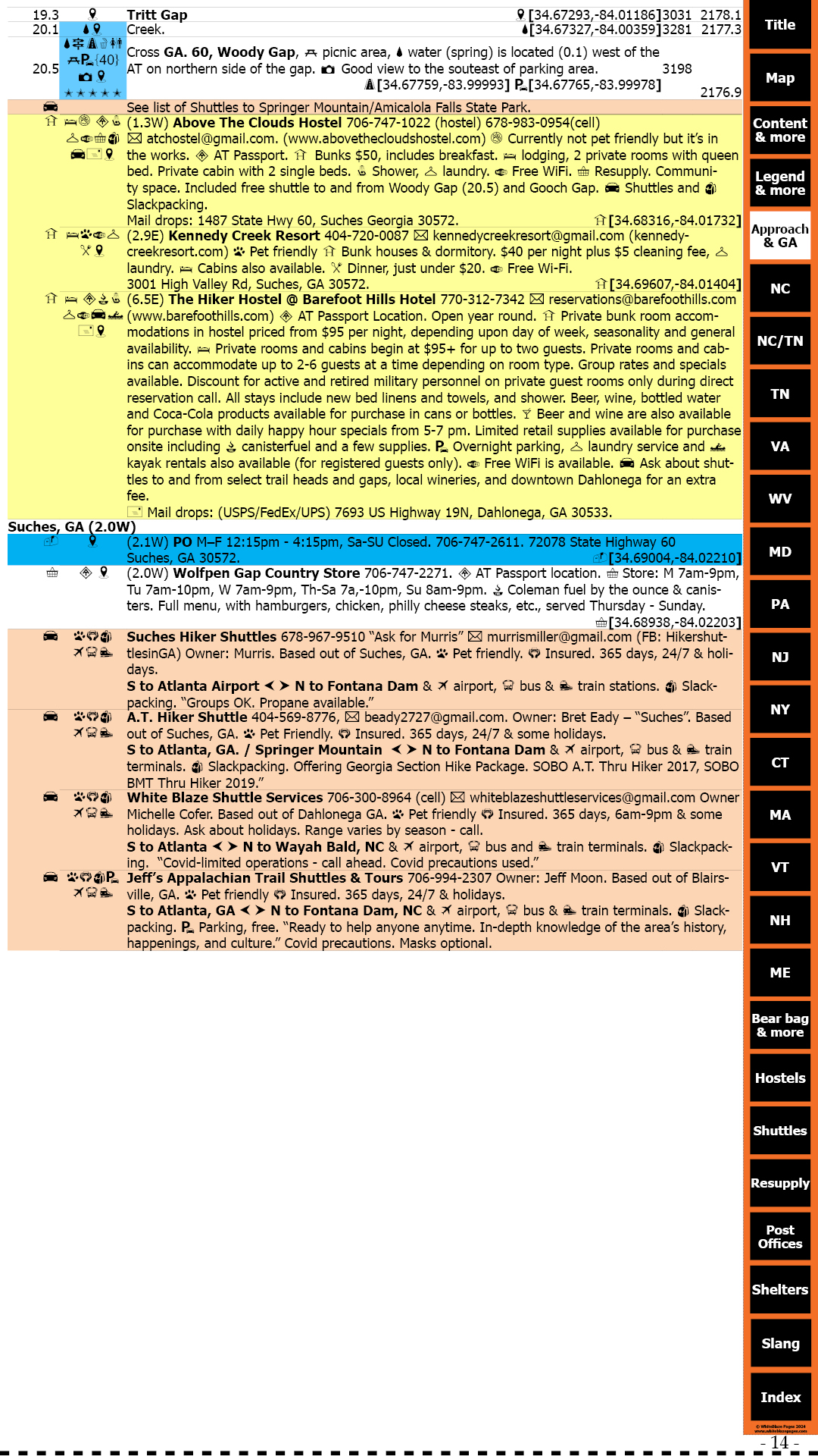
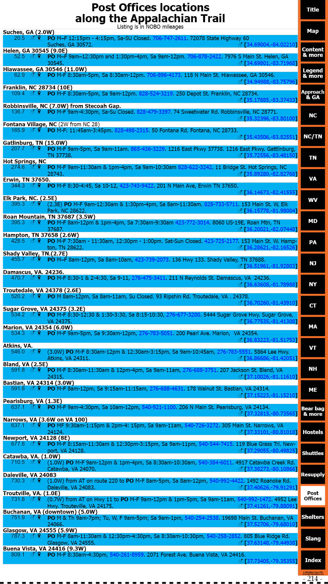
- City and town informational entries, in sequential order, referenced to trail mileage, in detail. No need to flip back-and-forth, 2 or 3 pages through the guidebook to locate needed information, unlike in other guidebooks.
- All maps are to scale, north oriented, showing the locations of thousands of establishments providing needed services, unlike other guidebooks that do not have their maps to scale.
- Many trail features: side trails, waterfalls, bridges, scenic views, attractions, road crossings, bridges, power lines, warnings, and much, much more!
- Complete Post Office addresses, phone numbers, and GPS coordinates in the town’s listings.
- Post Offices are also listed in their physical locations where you would use them along the Appalachian Trail.
- Listing of Appalachian Trail resupply locations. Good for pre-hike planning.
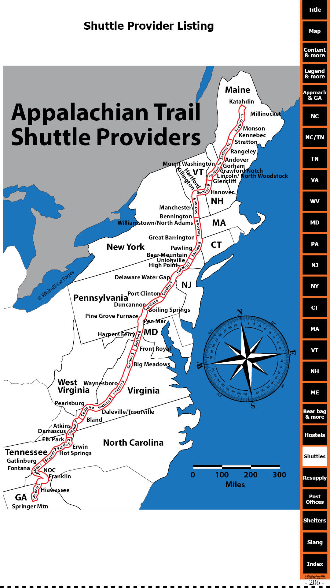
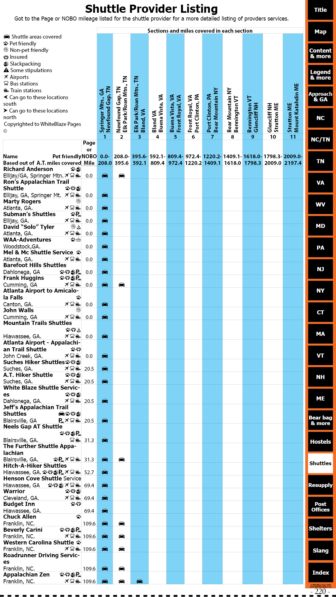
- Includes an extensive listing of all shuttle providers along the entire length of the Appalachian Trail, with descriptions and shuttle service area map. The most up-to-date listing in publication!
- Approach Trail, including profile, elevations, coordinates, and Amicalola Falls State Park information.
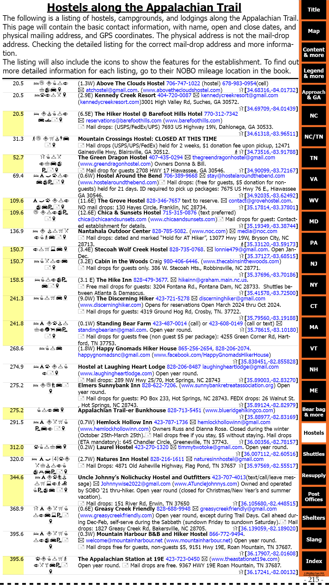
- Contains a separate Hostel listing of all Hostels. Hostels are also listed in their physical locations where you would use them along the Appalachian Trail.
- Includes a table of contents. Index for the book, and index of maps included in the book.
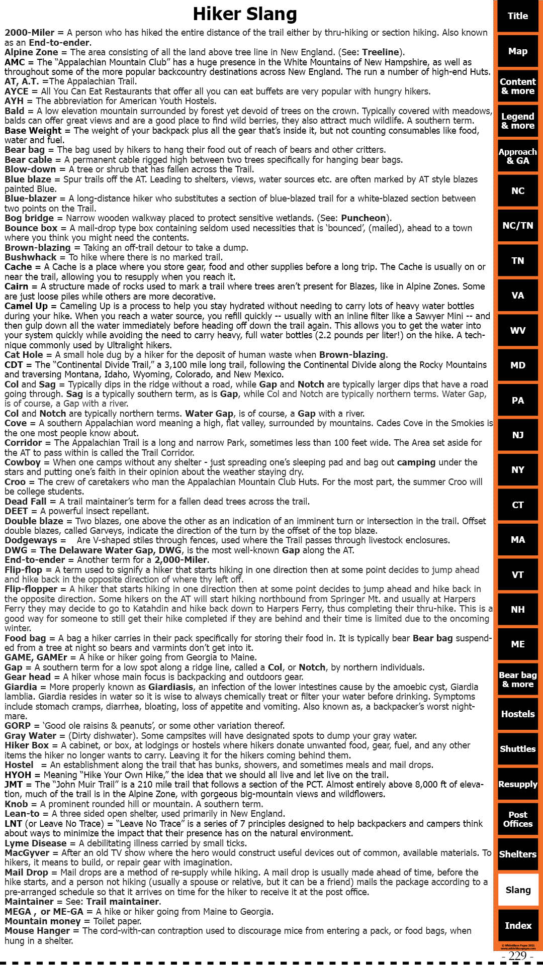
- Hiker Slang, commonly used hiker terms.
Thank you for considering WhiteBlaze Pages.
Our success is due to the feedback from hikers using the guidebook.
I can keep the price low because there is no staff other than me, Rick.
Everyone else volunteers their inputs.
I am dedicated to providing hikers with the best guidebook and keeping it at an affordable price.
For the price of keeping the guidebook so low, I only ask one favor in return.
Your inputs are what makes the guidebook so successful and what keeps me publishing it.
I only ask that you provide me with feedback of anything that you find incorrect, updates, or would like to see added.
Trail Pages Guidebook corrections/additions/feedback
Adobe Acrobat issue
I also wanted to bring up an issue that some people are having with Adobe Acrobat not loading the PDF correctly on their mobile app.
This is an Adobe Acrobat issue. I have been working with Adobe on this issue. They have advised me that they are working on this issue, and it should be fixed by next quarter.
There are alternative free mobile apps you can use that also work.